12 Years After the 2014 Deluge, Kashmir Still Waits for a Comprehensive Flood Management Roadmap
By: News Desk | 02 Aug 2026
Twelve Years On, Kashmir’s Flood Question Is Still Unresolved
Twelve years after the catastrophic September 2014 floods, Kashmir continues to face an uncomfortable question: How prepared is the Valley for another extreme flood?
The answer is complicated.
It would be inaccurate to say that nothing has been done since 2014. The government has undertaken and proposed several flood-control and river-management works, including dredging, embankment strengthening, flood-spill-channel interventions and studies. Official documents also show that a broader Comprehensive Plan for Flood Management Works on the Jhelum and its tributaries has been prepared, with measures including re-sectioning the Flood Spill Channel, widening parts of the outfall channel, strengthening banks and addressing tributary erosion.
But the larger concern remains: Kashmir still lacks a visibly completed, fully integrated flood-resilience system capable of addressing the entire Jhelum basin as one interconnected hydrological unit.
That distinction is crucial.
The debate is no longer simply about whether a channel should be dredged or a bund repaired. It is about whether Kashmir has developed a long-term strategy that simultaneously addresses river capacity, floodwater diversion, wetlands, sedimentation, urban expansion, drainage, tributaries, land-use planning and increasingly erratic rainfall.
Experts and government agencies have repeatedly discussed many of these interventions. Yet several major components remain at the planning, survey, prioritisation or execution stage.
A recent government tender, for example, sought updated topographical survey work for the approximately 48-km Flood Spill Channel, with re-sectioning proposed to improve its carrying capacity and hydraulic efficiency. This indicates that key infrastructure is still undergoing assessment and redesign more than a decade after the 2014 disaster.
For residents who lived through 2014, this creates a lingering sense of vulnerability.
The fear is not simply of another flood.
It is of another flood arriving before the Valley is ready.
The 2014 Flood Was a Warning Kashmir Could Not Ignore
The September 2014 floods remain one of the most devastating natural disasters in Kashmir’s recent history.
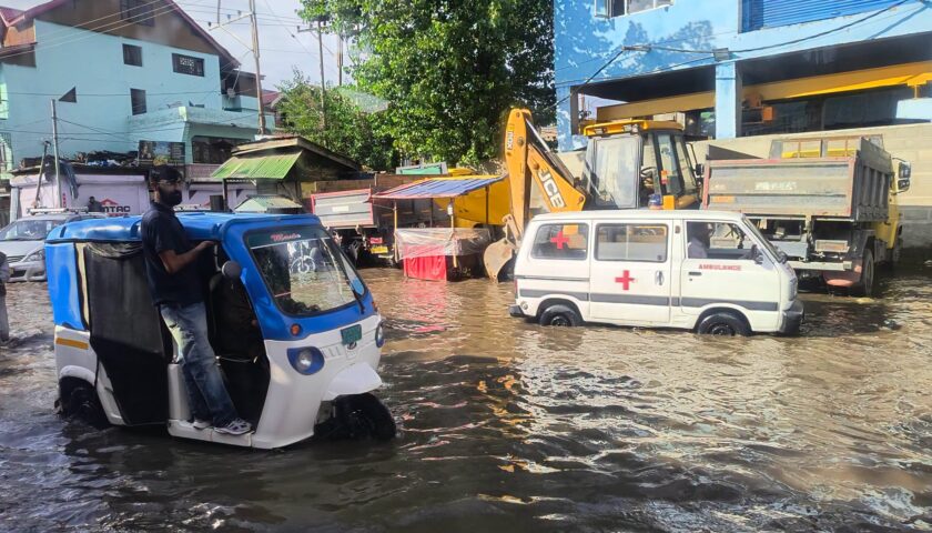
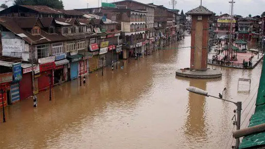
The disaster exposed the vulnerability of Srinagar and large parts of the Valley to extreme rainfall and rapid rises in the Jhelum and its tributaries. Residential neighbourhoods, commercial centres, hospitals, roads, bridges and public infrastructure were inundated.
The memory of water entering homes and businesses has not disappeared.
Neither has the underlying geography that made the disaster possible.
The Kashmir Valley is a relatively enclosed basin. The Jhelum is its principal drainage artery, while tributaries feed water into the river from different parts of the Valley. At the northern end, the river interacts with Wular Lake before continuing towards Baramulla and the downstream gorge.
This means flood management cannot realistically be reduced to one location.
A problem upstream can quickly become a problem downstream.
A blocked or undersized drainage channel in Srinagar can worsen urban flooding. Excessive sediment in a river or channel can reduce carrying capacity. The loss or degradation of wetlands can remove natural storage capacity. Intense rainfall over tributary catchments can send sudden volumes of water into the main river system.
The 2014 experience demonstrated precisely how interconnected these factors are.
Kashmir’s Flood Problem Is Bigger Than Dredging
One of the most persistent responses to flood risk has been dredging.
Dredging can certainly play an important role where sediment accumulation restricts water flow. But hydraulic experts and flood-management specialists have long argued that dredging alone cannot provide a permanent solution to a basin-wide flood problem.
The reason is simple.
If a river carries large quantities of sediment from its tributaries, the problem does not end after one dredging operation. Sediment returns. Channels change. Riverbanks erode. Wetlands shrink. Urban areas expand. Rainfall patterns evolve.
Flood management therefore requires a system rather than a single project.
Official post-2014 planning documents have included a much broader range of interventions. These include raising vulnerable riverbanks, re-sectioning the Flood Spill Channel, widening the outfall channel in sections between Sopore and Baramulla, creating additional flood channels and undertaking anti-erosion works in tributaries.
That broader approach is important.
But the real question is whether these proposals have been implemented at the scale and speed required to meaningfully reduce risk.
The Flood Spill Channel: Kashmir’s Critical Safety Valve
The Flood Spill Channel is one of the most important pieces of Kashmir’s flood-management infrastructure.
The channel, which begins near Padshahi Bagh in Srinagar and ultimately connects towards the Wular system, was designed to divert excess water from the Jhelum and reduce pressure on the river as it passes through Srinagar.
Government records describe the channel as approximately 48–49 kilometres long, depending on the measurement scope, and identify re-sectioning as an important requirement for improving its hydraulic efficiency.
Historically, the channel’s carrying capacity has been enhanced through dredging and related works. Official records have cited an increase in capacity from around 4,000 cusecs to 8,000 cusecs through earlier interventions.
But the question facing engineers today is whether the existing system is adequate for the scale of flood events Kashmir may face in the future.
The answer cannot be based solely on historical assumptions.
A flood-management system designed for yesterday’s conditions may not be sufficient for tomorrow’s rainfall extremes.
Recent government planning itself points towards the need for re-sectioning of the Flood Spill Channel. That suggests that the channel’s present configuration and hydraulic performance remain important areas of concern.
The challenge is therefore not merely to maintain the channel.
It is to ensure that the entire diversion system works when Kashmir needs it most.
Wular Lake and the Outfall Bottleneck
Wular Lake is central to any serious discussion about flood management in Kashmir.
The lake functions as a major component of the Valley’s hydrological system, receiving water from the Jhelum before the river continues downstream.
But flood management depends not only on how much water can enter a storage body.
It also depends on how efficiently water can move through the system.
Hydrological studies have highlighted the importance of the Wular–outfall system and the downstream route through Baramulla. A research review of Himalayan flood-management challenges notes that the narrow downstream configuration, including the outfall and Baramulla gorge, can become a major constraint on the movement of floodwater.
This is why experts have repeatedly discussed interventions beyond simply deepening the Jhelum.
A broader outfall system, wherever technically and environmentally feasible, could theoretically improve the rate at which excess water moves through the basin. The challenge, however, is substantial: such interventions would have to account for engineering feasibility, land acquisition, environmental safeguards, sediment behaviour and downstream impacts.
The answer, therefore, cannot be a simplistic “widen everything”.
It must be based on modern hydraulic modelling and a basin-wide assessment of where water accumulates, where it slows and where interventions could safely increase discharge.
Detention Basins: The Missing Buffer in a Changing Climate
One of the most important ideas in modern flood management is to slow water down before it becomes a crisis.
This is where detention or sediment-control basins can play a role.
Instead of allowing every sudden surge of water from tributaries to enter the main Jhelum system simultaneously, strategically located detention areas can temporarily hold peak flows and release them more gradually.
Such infrastructure is particularly relevant in a basin where intense rainfall can rapidly increase discharge from tributaries.
Government flood-management planning has discussed sediment-control basins on identified Jhelum tributaries, alongside other measures such as diversion channels, flood walls, Flood Spill Channel re-sectioning and flood zoning.
The key issue is execution.
A proposal on paper does not reduce flood risk.
A functioning detention basin does.
Kashmir therefore needs clarity on which proposed basins have been identified, which have received technical approval, which have been funded and which have actually been completed.
That transparency would help residents understand how much of the post-2014 flood strategy exists on the ground rather than in official documents.
Wetlands Must Be Treated as Flood Infrastructure
There is another dimension to the flood debate that often receives less attention: Kashmir’s wetlands.
Wetlands are not merely ecological assets.
They can also act as natural buffers by temporarily storing water during periods of heavy rainfall and high river discharge.
The Flood Spill Channel itself passes through or interacts with important wetland areas, including Hokersar and Nowgam Jheel, making the relationship between flood engineering and wetland conservation particularly important.
This creates a policy dilemma.
Engineering interventions may be necessary to improve water movement, but poorly planned construction can damage the very natural systems that help absorb excess water.
The solution is not to choose between development and conservation.
It is to integrate both.
A modern flood roadmap for Kashmir should therefore treat wetlands, lakes, floodplains and natural drainage corridors as part of the region’s flood-control infrastructure.
Protecting them is not simply an environmental responsibility.
It is also disaster-risk reduction.
Srinagar and South Kashmir Remain Particularly Exposed
The risk is not distributed evenly across the Valley.
Srinagar’s low-lying urban areas remain vulnerable because of their proximity to the Jhelum, extensive urbanisation and dependence on drainage infrastructure.
South Kashmir also deserves special attention because the Jhelum and its tributaries begin accumulating water from the upper catchments before the river reaches Srinagar.
A major rainfall event in the south can therefore become a downstream threat.
The chain is interconnected:
Heavy rainfall → tributary surge → rising Jhelum levels → pressure on the Flood Spill Channel → water accumulation in low-lying areas → drainage stress → urban flooding.
Breaking that chain requires intervention at multiple points.
That is precisely why a fragmented approach is unlikely to be enough.
The Climate Question Can No Longer Be Ignored
The climate dimension adds urgency to Kashmir’s flood debate.
Weather patterns are becoming increasingly difficult to predict, while short-duration, high-intensity rainfall events can produce rapid runoff and flash-flood conditions.
This does not mean every extreme rainfall event can automatically be attributed to climate change.
But it does mean that infrastructure planning based solely on historical averages may carry greater risk.
Flood-management systems must be designed with changing rainfall intensity, urban expansion and altered land-use patterns in mind.
The objective should be to build climate-resilient infrastructure, not simply restore infrastructure to the standards of the past.
That means updated rainfall and discharge modelling, real-time river monitoring, improved early-warning systems and infrastructure capable of handling extreme scenarios.
A Governance Problem as Much as an Engineering Problem
Perhaps the most important lesson from the post-2014 experience is that flood management cannot belong to one department alone.
The Jhelum basin cuts across multiple administrative and functional responsibilities.
Flood control involves:
- Irrigation and Flood Control
- Disaster Management
- Urban development
- Municipal authorities
- Wetland and lake conservation agencies
- Roads and bridges
- Environment and ecology
- Land-use planning
- Meteorological and hydrological monitoring
When these agencies work independently, the result can be fragmented planning.
A flood channel may be improved while a nearby drainage route is blocked.
A wetland may be protected on paper while surrounding land-use changes reduce its storage capacity.
A riverbank may be strengthened while sediment continues to accumulate upstream.
This is why Kashmir needs a single, publicly accountable flood-resilience framework with clear deadlines, funding commitments and measurable targets.
The government has already discussed many components of such a framework. A 2025 review meeting, for instance, considered a range of measures including a possible diversion channel from the Jhelum near Sangam towards Wular Lake, selected flood walls, Flood Spill Channel re-sectioning, sediment-control basins, flood zoning and land-use regulation.
The challenge now is moving from repeated discussions to coordinated implementation.
What a Comprehensive Kashmir Flood Roadmap Should Include
A credible long-term flood strategy should have at least seven interconnected pillars.
1. Modern Hydraulic Modelling
Kashmir needs updated modelling based on current rainfall patterns, river discharge, sediment movement and urban development.
2. Flood Spill Channel Re-Engineering
The Flood Spill Channel should be assessed and re-sectioned wherever required, with its full length and hydraulic performance evaluated as one system.
3. Outfall and Downstream Capacity
The Jhelum’s downstream bottlenecks must be studied carefully, including the outfall route towards Baramulla and Wular.
4. Detention and Sediment-Control Basins
Strategically located basins could help manage peak flows and reduce sediment loads entering the main river system.
5. Wetland Protection
Hokersar, Nowgam Jheel, Wular and other natural water-retention systems should be integrated into flood planning rather than treated as separate environmental concerns.
6. Floodplain and Land-Use Regulation
Construction in vulnerable flood-prone areas should be controlled through transparent zoning and strict enforcement.
7. Early Warning and Emergency Preparedness
Engineering alone cannot eliminate flood risk. Kashmir needs stronger forecasting, real-time monitoring, evacuation plans, public alerts and community-level preparedness.
The Real Test Is Not Another Plan—It Is Implementation
Kashmir has no shortage of reports, studies, proposals and meetings on flood management.
What is missing is a clear public picture of the implementation pipeline.
Which recommendations have been completed?
Which are under construction?
Which remain pending?
What is the funding status?
What are the deadlines?
Who is responsible for delivery?
These are legitimate questions, especially after the Valley experienced the devastation of 2014.
A transparent public dashboard tracking major flood-mitigation projects could provide a straightforward answer.
Such a system would also help separate political claims from measurable progress.
Twelve Years Later, the Cost of Waiting Is Rising
The phrase “12 years after the 2014 floods” is more than a timeline.
It represents a shrinking window for prevention.
Every year without comprehensive implementation increases exposure—not necessarily because another 2014-scale flood is inevitable, but because population, infrastructure and economic activity continue to expand in vulnerable areas.
Srinagar is growing.
Roads and bridges are carrying more traffic.
Residential colonies are expanding.
Commercial investment is increasing.
Tourism infrastructure is spreading.
All of this means that the potential economic cost of a major flood could be significantly higher than it was in the past.
The flood question, therefore, is also an economic question.
It is about protecting homes, businesses, hospitals, schools, roads, tourism facilities and public infrastructure.
It is about investor confidence.
It is about whether development in Kashmir is being matched by investment in resilience.
Conclusion: Kashmir Cannot Afford to Wait for the Next 2014
The central lesson is straightforward.
Kashmir does not need another cycle of promises followed by delays. It needs a clearly defined, integrated and time-bound flood-resilience roadmap.
The available evidence does not support the simplistic claim that no flood-management work has been undertaken since 2014. Significant planning and infrastructure interventions have been carried out or proposed. But the continued emphasis on re-sectioning, hydraulic surveys, diversion channels, outfall capacity, sediment control and flood zoning shows that the broader challenge remains unfinished.
The next phase must therefore be about integration.
A wider and more efficient outfall where technically justified.
A properly functioning Flood Spill Channel.
Detention and sediment-control basins.
Protected wetlands.
Stronger tributary management.
Modern flood forecasting.
Strict floodplain regulation.
And, above all, coordinated governance.
The 2014 floods should be remembered not only as a tragedy but as a warning.
Twelve years later, Kashmir has an opportunity to turn that warning into a comprehensive strategy.
The real measure of preparedness will not be how quickly authorities respond when water begins to rise.
It will be whether they have done enough before the water rises.