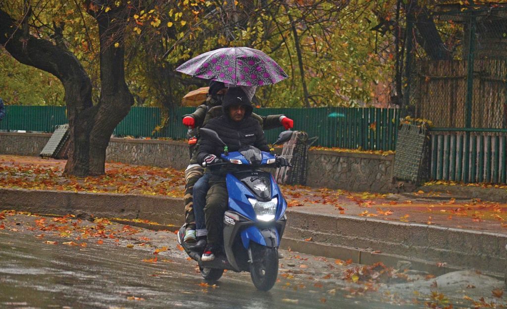
Rains lashed Kashmir since Tuesday night bringing respite from the hot weather conditions even as the Meteorological Department has predicted rainy weather conditions to continue on Thursday.
As per MeT Department “moderate rain and thunderstorms across J&K will continue on Thursday with heavy rain likely at some places in Jammu.”
Deputy Director MeT, Mukhtar Ahmad, told the Kashmir Post that a “significant improvement in weather is expected from Friday.”
“Intermittent rain is likely till Thursday evening after which weather will improve. But weather across the Valley will witness significant improvement only Friday onwards,” Ahmad said. The MeT official said the present spell of rainfall has “brought an end to the recent heat wave and also reduced the rainfall deficit to some extent.”
In view of the forecast for rainfall till Thursday, MeT department has issued an alert “for flash floods and landslides in vulnerable spots especially in hilly areas of J&K and Zojila.” A cloudburst took place at Nowshara Srigufwara in Anantnag on Wednesday morning but there was no loss of life or damage to property.
As per MeT data, summer capital Srinagar recorded 34.3 millimetres of rainfall between Tuesday morning and 5:30 pm on Wednesday.
The rainfall brought a great relief from the sizzling temperatures as Srinagar on Wednesday recorded a pleasant 22.6 degree Celsius which is 6.6 degree below normal. Just a day earlier, Srinagar had recorded 32.9 degrees. However, intermittent rainfall since Tuesday has led to water-logging of roads and streets at several places of the summer capital.
The ski-resort Gulmarg recorded 37.2 mm rainfall while Qazigund recorded 26.4 mm, Pahalgam 27.3 mm, Kupwara 11.2 mm, Kokernag 24 mm between Tuesday morning and Wednesday 5:30 pm. Winter capital Jammu was lashed by heavy rains as it recorded almost 66.7 mm rainfall during this period while Banihal 22.8 mm, Katra 37.4 mm and Batote 22.2 mm rainfall. Heavy rainfall caused landslides and shooting stones on the 270-kilometre Srinagar-Jammu National Highway blocking this arterial road. Bhaderwah recorded 41.3 mm rainfall between Tuesday and Wednesday 5:30 pm, MeT data said.
Although water levels have increased in most of the water bodies that had dried up due to a long dry spell, the gauge reading of river Jhelum and its tributaries as per Irrigation and Flood Control Department at 6 pm on Wednesday indicated that water levels were well below the danger mark. The water level of Jhelum at Sangam was recorded 4.89 feet, Pampore 1.10 meter, Ram Munshibagh 5.61 feet, Asham 4.10 feet, Vishow nallah 2.8 meter and Rambiara at Vachi 0.23 meters, Nallah Lidder 1.22 meter, Doodhganga Barzulla 1.54 meter and at Sindh nallah Duderhama Ganderbal 1.46 meter.
The present spell of rainfall has lashed the Valley after hot weather conditions prevailed for the last few weeks. Srinagar had witnessed its highest ever day temperature of August recorded in the last 39 years. On August 17, Srinagar sizzled at 35.7 degree Celsius. It may also be recalled that Jammu & Kashmir recorded deficient rainfall of 54 per cent between June 1 and August 17, which had put Valley’s farm produce on the brink of suffering huge losses.