Dal Lake Filling Row: EPG Seeks Probe Into Alleged Reclamation Near Miskeen Bagh
By: News Desk | 31 August 2026
Dal Lake Under Pressure: EPG Seeks Probe Into Alleged Filling Near Miskeen Bagh
Srinagar: A fresh environmental controversy has emerged around Kashmir’s iconic Dal Lake after the Environmental Policy Group (EPG) urged Chief Minister Omar Abdullah to order an on-ground investigation into a video circulating on social media that allegedly shows filling or reclamation activity near the Lakes Conservation and Management Authority (LCMA) office at Miskeen Bagh.
At this stage, the video itself does not establish that illegal filling or encroachment has taken place. The precise location, nature of the activity and legal status of the land shown still require official verification.
That distinction matters.
But so does the larger question raised by the controversy: how much pressure can Kashmir’s lakes, wetlands and natural drainage systems absorb before ecological damage becomes difficult—or impossible—to reverse?
EPG Convenor Faiz Ahmad Bakshi has asked the authorities to physically inspect the site, establish what the video actually depicts and determine whether any portion of the lake or its adjoining area has been filled, reclaimed, obstructed or otherwise altered.
The demand comes against a much wider backdrop. Government audits and official statements have documented longstanding problems involving land-use changes, blocked drainage channels, construction activity, pollution, siltation and encroachment pressures around Dal Lake and other water bodies of Jammu & Kashmir.
In other words, the latest allegation is new. The ecological vulnerability behind it is not.
What Triggered the Dal Lake Filling Controversy?
The immediate trigger is a video circulating on social media that allegedly shows filling or reclamation close to the LCMA office at Miskeen Bagh.
EPG has not presented the video as conclusive proof of an illegal act. Instead, it has asked the administration to answer the questions that a credible investigation should answer:
- Where exactly was the video recorded?
- What activity is taking place at the location?
- Is the material being deposited on lake land, wetland, a drainage channel or privately held land?
- Has the physical extent of the lake or its associated water channel been altered?
- Who owns or controls the land?
- What does the official revenue record classify the land as?
- Was any permission granted for the activity?
- Could the work affect water flow or drainage into Dal Lake?
These are not merely technical questions.
In a densely developed urban environment such as Srinagar, even a relatively small alteration to a water channel or lake fringe can have consequences far beyond the immediate site.
That is why EPG has called for a joint spot inspection involving LCMA and other concerned departments, rather than relying solely on a video circulated online.
The proper response, therefore, is neither to dismiss the allegation as social-media speculation nor to declare an encroachment proven before an inspection has taken place.
The answer lies in independent verification.
EPG Wants the Land Records Checked Too
One of the more significant aspects of the EPG’s demand is its request for verification of the site’s ownership, land classification, revenue status and permissible land use.
That is important because the legal and environmental status of land cannot always be determined simply by looking at its present physical appearance.
An area adjoining a lake may appear dry or reclaimed today while historically forming part of a water system, drainage corridor or wetland. Conversely, an apparently vacant area near a lake is not automatically part of the lake itself.
A credible investigation would therefore need to compare multiple layers of evidence:
Revenue records + cadastral maps + historical satellite imagery + current satellite imagery + GIS boundaries + field measurements + hydrological characteristics.
That would provide a much stronger basis for determining whether the landscape has actually changed.
EPG has specifically proposed greater use of GIS and satellite-based monitoring for precisely this reason.
Why Dal Lake Is More Than a Tourist Landmark
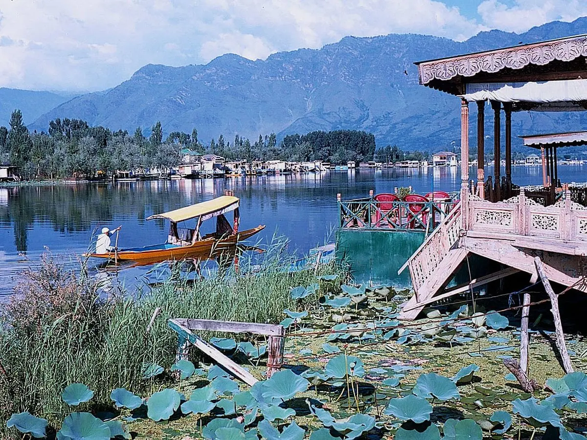
For visitors, Dal Lake is often associated with shikaras, houseboats, floating gardens and the dramatic backdrop of the Zabarwan mountains.
Ecologically, however, it is much more complicated.
A lake is not simply the water visible from its shoreline.
It is part of a larger system involving its catchment, inflow channels, drainage network, wetlands, groundwater interactions, vegetation and surrounding land.
Alter one part of that system and the consequences can travel downstream—or become visible years later.
This is why the debate around Dal Lake cannot be reduced to whether one patch of land has been filled.
The bigger issue is whether the lake’s natural capacity to store, circulate and drain water is being progressively weakened by multiple small interventions.
CAG Audit Shows the Problem Is Bigger Than One Video
The EPG’s concerns acquire additional significance when viewed against the findings of the Comptroller and Auditor General of India.
The CAG’s Report No. 4 of 2025 on the conservation and management of lakes in Jammu & Kashmir examined Dal Lake and several other major water bodies. The report was tabled on March 30, 2026, and included audit observations covering conservation efforts and land-use changes.
The audit recorded several problems in and around Dal Lake’s drainage system.
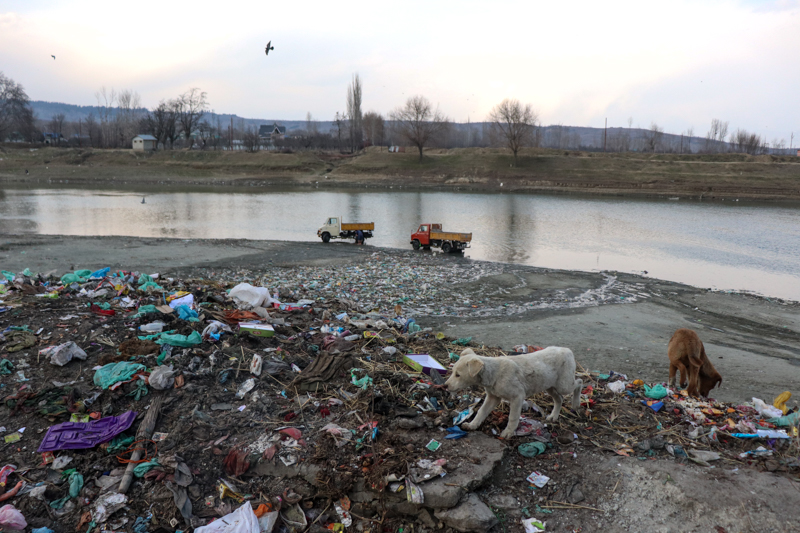
Among its observations were instances where nallahs were blocked by road construction, construction material was dumped into drainage channels, silt had accumulated in nallahs and drains, and household drains were flowing into channels that ultimately reached the lake. The audit also recorded garbage and other waste in nallahs.
In one particularly striking observation, the CAG documented a case involving the Tailbal nallah, described as a major source of water for Dal Lake, where toe walling had been carried out significantly inside the earlier alignment, resulting in a reduction in the channel’s width. The audit also recorded earth filling and waste material around drainage channels.
These findings are important because they demonstrate that the lake’s vulnerability is not limited to visible dumping directly into open water.
The drainage network feeding and surrounding the lake matters just as much.
A blocked nallah, narrowed channel or altered flood corridor can gradually change how water enters, leaves or moves through an interconnected lake system.
Dal Lake Has Already Experienced Significant Land-Use Change
The CAG audit also examined spatial and temporal changes around Dal Lake.
According to findings reported from the audit, the lake’s water body area declined from 15.40 square kilometres in 2007 to 12.91 square kilometres in 2020, a decline of about 10.15 per cent. At the same time, other land-use categories, including floating vegetation, cropland/plantation and built-up areas, increased.
The figures should not be interpreted as meaning that every square kilometre of change represents illegal reclamation.
Lake ecosystems naturally experience changes in vegetation, sedimentation and seasonal conditions, while conservation and dredging operations can also alter mapped land-use categories.
That is precisely why the CAG’s findings are significant: they point to persistent changes in the lake ecosystem that require systematic management and explanation.
The audit also highlighted problems involving pollution inflows, sewage treatment, de-weeding, land-use regulation and monitoring.
So, when EPG asks authorities to investigate a fresh allegation of filling, it is doing so against a documented history of pressure on the lake—not in an environmental vacuum.
The Government Says Conservation Work Is Also Underway
There is another side to the story, and it should not be overlooked.
Authorities have undertaken substantial conservation and restoration measures around the Dal-Nigeen ecosystem.
Government statements in the J&K Legislative Assembly have cited dredging, reopening blocked channels, maintenance of inflow nallahs, sewage-treatment infrastructure, catchment fencing and regular water-quality monitoring. Five sewage treatment plants with a combined capacity of 36.73 MLD have been reported for domestic sewage from peripheral and adjoining areas, while hundreds of houseboats have been connected to existing treatment infrastructure.
The government has also said that new construction is not permitted within the lake area and the 200-metre buffer zone referred to in court directions, alongside anti-encroachment drives and enforcement measures against illegal transportation of construction material.
In February 2026, officials also reported that extensive conservation work had removed aquatic vegetation, reopened navigation channels and improved water circulation in parts of the Dal-Nigeen ecosystem.
These efforts demonstrate that the administration is not ignoring the lake.
But they also underline the central challenge:
Conservation cannot succeed if restoration work is repeatedly undermined by new encroachments, drainage obstruction or uncontrolled land-use changes.
Why Filling a Water Body Can Become a Flood Risk
The environmental significance of wetlands and natural drainage channels becomes particularly clear during extreme rainfall.
Water needs somewhere to go.
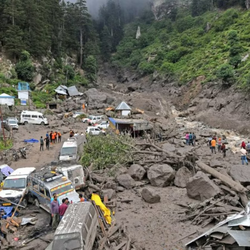
When wetlands, flood channels and nallahs remain functional, they can temporarily store, slow or convey excess water. When these systems are narrowed, blocked or filled, water can be pushed into roads, neighbourhoods and built-up areas.
This is why wetland conservation should not be treated merely as a biodiversity issue.
It is also an urban safety issue.
Kashmir’s changing rainfall patterns and increasing exposure to extreme weather make this even more important. The ecological services provided by lakes and wetlands—water storage, flow regulation, habitat protection, groundwater interaction and sediment retention—are increasingly relevant to climate adaptation.
In that sense, a wetland is not empty land waiting for development.
It is a piece of natural infrastructure.
And unlike a concrete drain, natural systems cannot simply be recreated elsewhere once their hydrological functions have been destroyed.
Kashmir’s Water Network Is Interconnected
EPG has therefore widened its concern beyond Dal Lake.
The organisation has called for greater scrutiny of Wular, Anchar, Nigeen, Manasbal, Khushal Sar, Gilsar and Hokersar, along with the Jhelum and its tributaries.
That wider approach is scientifically sensible.
Kashmir’s water bodies form part of interconnected hydrological landscapes rather than isolated blue patches on a map.
The National Green Tribunal has previously highlighted concerns surrounding several J&K lakes, including Dal, Wular, Manasbal, Nigeen, Anchar, Hokersar, Gilsar and Khushal Sar, and called for effective management and monitoring.
This means the protection of one lake cannot be separated entirely from the condition of the surrounding catchment.
A lake may be cleaned mechanically while its feeder channels continue carrying silt.
A drainage channel may be widened while sewage continues entering it.
A wetland may be fenced while its hydrological connection is gradually lost.
Conservation has to work as a system.
Satellite Mapping Could Change the Encroachment Debate
One of EPG’s most practical proposals is the use of GIS, satellite imagery and drone surveys to monitor water bodies and their buffer zones.
This could significantly improve accountability.
Instead of waiting for a complaint to go viral, authorities could establish a baseline map of each major water body and compare it periodically with updated imagery.
A monitoring system could track:
- Changes in open-water area
- Expansion of built-up areas
- New earth filling
- Changes in drainage-channel width
- Construction near lake boundaries
- Encroachment into buffer zones
- Changes in wetland vegetation
- New roads or embankments
- Dumping of construction debris
- Alterations in natural inflow and outflow channels
The technology already exists.
The challenge is institutional consistency.
Satellite imagery can identify a change. But someone still has to inspect the location, check records, determine legality, issue notices where necessary and ensure that violations are not simply allowed to return after an enforcement drive.
The Viral Video Needs Verification—Not Assumption
This is perhaps the most important point in the current controversy.
A social-media video can be an important trigger for public scrutiny, but it is not automatically an environmental audit.
Before concluding that Dal Lake has been illegally filled, investigators need to establish:
Location → date → activity → land status → historical boundary → permission → environmental impact.
The government should therefore make the verification process as transparent as possible.
If the video shows lawful work on land that is legally classified outside the lake boundary, the authorities should say so.
If it shows filling of a water body, illegal reclamation or obstruction of a drainage channel, the government should identify the violation and take action.
And if the evidence is inconclusive, that too should be communicated honestly.
Environmental governance becomes stronger when facts are published—even when those facts complicate the original allegation.
What an Independent Dal Lake Verification Should Include
A credible investigation should go beyond a visual inspection.
1. Joint site inspection
LCMA, revenue officials, municipal authorities and relevant technical departments should inspect the location together.
2. Revenue and cadastral verification
The administration should establish the legal classification and ownership of the land.
3. Historical satellite comparison
Archived imagery should be compared with current imagery to identify whether the landform or water extent has changed.
4. GIS boundary verification
The official lake boundary and buffer-zone limits should be overlaid with the present site.
5. Hydrological assessment
Experts should determine whether the activity has affected a nallah, drainage channel, flood path or water inflow.
6. Construction-material investigation
If earth, debris or other material has been deposited, its source and quantity should be established.
7. Public disclosure
The findings should be placed in the public domain, particularly if the investigation establishes an environmental violation.
This would turn a social-media controversy into something much more valuable: a transparent environmental investigation.
The Bigger Problem: Death by a Thousand Small Encroachments
The greatest danger to Kashmir’s lakes may not always come from one dramatic act of reclamation.
It can happen incrementally.
A channel is narrowed by a wall.
A wetland edge is filled with soil.
Construction debris is dumped beside a nallah.
A road interrupts natural drainage.
A building appears closer to a water channel.
A settlement expands.
Vegetation changes.
Silt accumulates.
None of these events alone may appear catastrophic.
Together, however, they can gradually transform the hydrology of an entire landscape.
The CAG’s findings around Dal Lake illustrate why this cumulative approach matters. The audit identified multiple interacting problems involving drainage, construction, sewage, land-use changes, monitoring and conservation management.
That is the environmental lesson Kashmir cannot afford to ignore.
Dal Lake Cannot Be Protected Only From the Lake
For decades, conservation debates have often focused on what happens inside Dal Lake.
But the lake begins far beyond its visible shoreline.
Its catchment, streams, nallahs, drainage channels, wetlands and surrounding settlements all influence its health.
Protecting the lake therefore requires protecting the landscape that feeds it.
That means stronger controls on land use, better sewage management, protection of drainage corridors, scientific catchment management and continuous monitoring.
It also means recognising that development and conservation do not have to be enemies.
Srinagar needs housing, roads, tourism infrastructure and economic growth.
But development that destroys natural drainage ultimately imposes a cost on the same population it is supposed to serve.
From Tourism Icon to Climate-Resilience Asset
Dal Lake is one of Kashmir’s biggest tourism symbols. But its value goes far beyond tourism.
Its ecological condition influences the wider environmental health and resilience of Srinagar.
That is why protecting the lake should not be framed as a choice between environment versus development.
The better question is:
What kind of development allows Srinagar to grow without destroying the natural systems that keep the city liveable?
The answer will increasingly depend on treating wetlands, flood channels, lakes and nallahs as infrastructure—just as seriously as roads, bridges and drainage pipes.
A concrete drain can be engineered.
A lake ecosystem takes decades, sometimes centuries, to evolve.
Destroying one is much easier than rebuilding it.
What Happens Next Will Matter
For now, the central allegation remains unverified.
EPG has asked the government to investigate a social-media video and determine whether filling, reclamation, dumping, channel alteration or unauthorised encroachment has occurred near Miskeen Bagh.
The administration now has an opportunity to respond in a way that goes beyond this individual controversy.
A transparent inspection could establish the facts.
A GIS comparison could establish whether the landscape has changed.
Revenue records could establish the legal status of the land.
Hydrological assessment could determine whether any water channel has been affected.
And if a violation is found, enforcement can establish whether existing safeguards are actually working.
The broader issue is already clear from official audits and government records: Dal Lake faces cumulative ecological pressures, even as significant conservation work continues.
That is why the latest controversy deserves careful attention—but also careful reporting.
The Real Test for Kashmir’s Water-Body Protection
The most important question is not simply whether the viral video is genuine.
It is whether Jammu & Kashmir can build a system in which such questions are answered before social media raises the alarm.
If every lake boundary is digitally mapped, every sensitive drainage corridor is monitored, every major land-use change is recorded and every credible complaint is independently investigated, environmental protection becomes preventive rather than reactive.
That is the model Kashmir needs.
Dal Lake should not be viewed as vacant land, a tourism backdrop or merely a beautification project.
It is a living ecological system and part of the Valley’s natural capital.
The EPG’s demand for verification, therefore, presents the administration with more than another complaint to process.
It presents an opportunity to demonstrate that in Kashmir, development may change the landscape—but it cannot be allowed to erase the natural systems that make the landscape viable in the first place.
Press Release
EPG seeks probe into alleged filling of Dal Lake, urges protection of J&K water bodies
Srinagar, Aug 31: The Environmental Policy Group (EPG) has sought the intervention of Chief Minister Omar Abdullah over a video circulating on social media that allegedly shows filling or reclamation of a portion of Dal Lake near the office of the Lakes Conservation and Management Authority (LCMA) at Miskeen Bagh.
In a letter addressed to the Chief Minister, EPG urged the competent authorities to verify the video and establish the exact location and nature of the activity shown. The group said the matter required prompt examination given the ecological importance and sensitivity of Dal Lake.
EPG Convenor Faiz Ahmad Bakshi said that if the activity shown in the video involves filling of a water body, reclamation of lake area, dumping of material, alteration of a water channel or unauthorised encroachment, it could raise environmental and regulatory concerns.
The group has sought a joint spot inspection by LCMA and other concerned departments to determine whether any portion of Dal Lake or its adjoining water area has been filled, reclaimed, encroached upon or otherwise altered.
It has also asked the authorities to verify the ownership, land classification, revenue status and permissible land use of the area shown in the video.
The EPG said the concern was not limited to Dal Lake and called for greater attention to the protection of water bodies and natural drainage systems across Jammu and Kashmir.
“Jammu & Kashmir possesses a highly interconnected network of lakes, wetlands, rivers, streams, springs, nallahs, flood channels and other natural water systems,” the group said.
It referred to Wular Lake, Anchar Lake, Nigeen Lake, Manasbal Lake, Khushal Sar, Gilsar and Hokersar, besides the River Jhelum and its tributaries.
“These water bodies are not vacant land available for gradual reclamation,” the EPG said, adding that they play a role in water storage, regulating flows, supporting biodiversity, groundwater recharge and flood protection.
The group also referred to Government of India documentation on encroachment pressures affecting the lacustrine systems of the Kashmir Valley and cited observations from the Comptroller and Auditor General’s report on the conservation and management of Dal Lake.
The EPG said the CAG report had recorded issues including blocked nallahs, construction affecting drainage, dumping of construction material and shrinkage of drainage channels.
The organisation has called for a comprehensive review of major lakes, wetlands, rivers, streams, springs, nallahs, flood channels and natural drainage systems across J&K to identify cases of encroachment, filling, reclamation and obstruction.
It has proposed GIS- and satellite-based mapping of major water bodies and their buffer areas, followed by physical verification on the ground.
The group has also suggested continuous monitoring of sensitive water bodies through satellite imagery, drone surveys, GIS mapping and periodic field inspections.
The EPG further urged the government to ensure that any filling, reclamation, construction or alteration affecting the natural extent or drainage characteristics of a water body is subjected to environmental, hydrological and technical scrutiny by the competent authorities.
It has also suggested treating natural flood channels, nallahs, wetlands and drainage corridors as important components of climate and disaster resilience.
The group has called for greater transparency in the handling of encroachment cases and suggested that information on identified encroachments and action taken by the authorities be made publicly accessible.
“Jammu & Kashmir’s water bodies are part of its natural capital,” the EPG said, adding that they should be protected while development activities are undertaken.
The group has requested the Chief Minister to direct the concerned authorities to examine the video, conduct an on-ground verification and take appropriate action if any violation is established.
Faiz Ahmad Bakshi
Convenor-EPG