Jammu & Kashmir Disaster Preparedness Under Pressure: Can the Valley Stay Ahead of the Next Disaster?
By: Javid Amin | 07 September 2026
From the 2014 floods to flash floods, cloudbursts and landslides, Jammu & Kashmir has repeatedly been reminded that geography can turn a weather event into a humanitarian crisis. The administration has expanded forecasting, emergency operations and vulnerability mapping, but the harder question remains: can warnings, plans and infrastructure reach people quickly enough when the mountains and rivers turn dangerous?
There is a peculiar contradiction at the heart of Jammu & Kashmir’s disaster story.
The Union Territory is not short of warnings about its vulnerability. Government plans have identified floods, earthquakes, landslides, avalanches, cloudbursts and other hazards for years. Forecasting systems exist. Emergency Operations Centres are being expanded. Vulnerable villages are being mapped. Rescue equipment and evacuation centres are being positioned.
And yet, every major spell of extreme weather seems to expose another weak point.
That is why the real challenge facing J&K is no longer simply whether a disaster can be predicted. It is whether that information can be converted into timely evacuation, safer infrastructure, trained communities and a coordinated response before a dangerous event becomes a disaster.
Recent developments have made the question particularly urgent.
In July 2026, authorities identified 654 vulnerable villages in the Kashmir Valley, covering an estimated 7.22 lakh people at risk from flash floods and landslides. More than 1,500 people were shifted to designated rescue centres as a precaution, while officials reported that rescue teams, emergency equipment and evacuation arrangements had been placed on alert. Across Jammu Division, another 363 vulnerable locations were identified.
The numbers are not a prediction of how many people will actually be affected by a future disaster. They are a measure of exposure. But they reveal something important: the risk is no longer theoretical, localised or confined to Srinagar.
A Landscape Where Nature Can Change the Rules in Hours
Jammu & Kashmir sits in one of the most geologically complex and environmentally sensitive parts of the Himalayas.
Steep mountain slopes, young and unstable geology, glacier-fed river systems, narrow valleys and rapidly expanding settlements create a combination in which hazards can cascade.
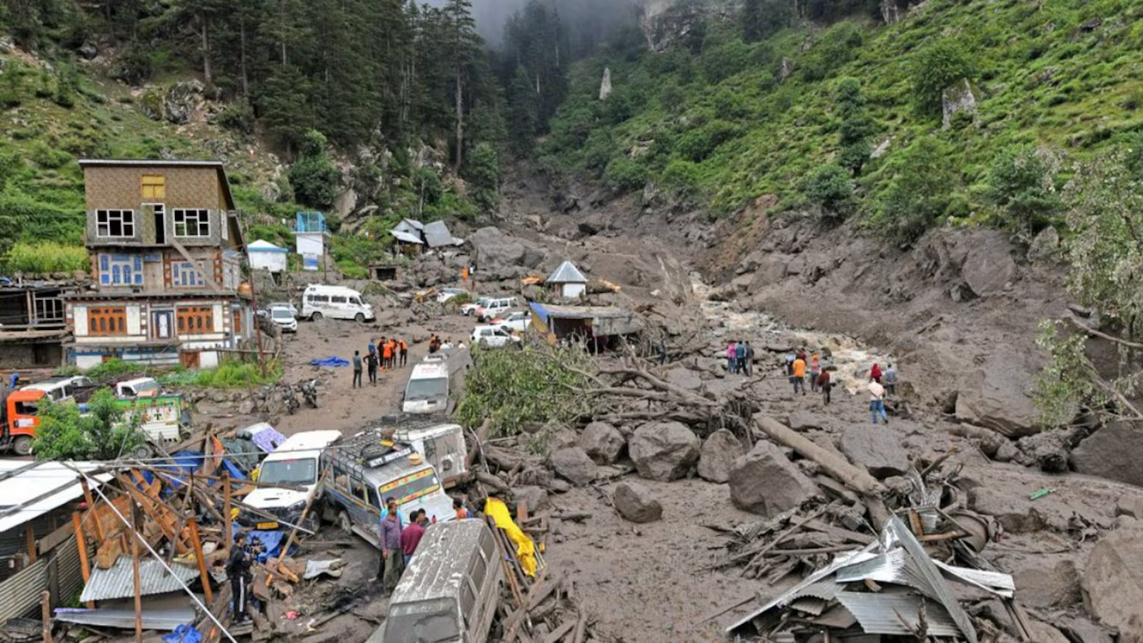
Heavy rain can trigger a landslide. A landslide can block a road or river channel. A blocked channel can suddenly release water downstream. A cloudburst can overwhelm drainage systems within minutes. In winter, heavy snowfall can create avalanche risks, while earthquakes remain a persistent threat because of the region’s tectonic setting.
This is what makes disaster management in the Himalayas fundamentally different from simply dealing with bad weather.
A rainfall forecast may provide valuable warning, but rainfall is only the first part of the chain. Authorities also need to know what that rain means for a particular slope, river, road, settlement, bridge or drainage network.
The Central Water Commission’s assessment of the September 2014 floods illustrates the problem vividly. At Srinagar, the Jhelum flood peak was estimated at around 3,200 cubic metres per second, while the river’s safe carrying capacity between Sangam and Srinagar was assessed at roughly 900 cubic metres per second. The resulting overflow inundated large low-lying areas.
But the 2014 disaster was not simply a story of extraordinary rainfall.
CWC also pointed to the loss of natural flood detention areas, urbanisation of low-lying land, encroachment and degradation of wetlands and waterways as factors that aggravated the impact. In other words, the disaster emerged from an interaction between extreme weather and human vulnerability.
That lesson remains highly relevant today.
The 2014 Floods Still Cast a Long Shadow
The September 2014 floods remain the clearest warning of what happens when natural hazards collide with dense settlements and inadequate resilience.
The disaster affected nearly two million people, according to CWC material, and caused extensive damage to homes, infrastructure, livelihoods and the regional economy.
The response that followed was not limited to relief.
The World Bank-backed Jhelum Tawi Flood Recovery Project (JTFRP) was sanctioned with an assistance package of ₹1,500 crore, with the stated objective not only of recovering damaged infrastructure but also of improving disaster resilience and the capacity of implementing agencies to respond to future emergencies.
Yet a 2026 CAG audit shows why recovery spending cannot automatically be equated with preparedness.
Of 213 JTFRP sub-projects, 174 had been completed by December 2023. But the audit found that important disaster-resilience components identified in the project’s appraisal documents had not been executed. These included retrofitting of critical buildings and a Hydro-Meteorological Action Plan intended to strengthen disaster-risk management and preparedness.
The audit also flagged delays, weaknesses in monitoring and project execution, irregular expenditure in some areas and idle investment in certain rescue and hospital equipment. It noted that Project Steering Committee meetings were not held regularly and that an operational manual for project execution had not been prepared.
This is perhaps one of the most important lessons for J&K’s future.
A disaster-resilient region cannot be built simply by announcing projects or purchasing equipment. The systems have to work together, be maintained, tested and used before the emergency begins.
The Risk Is Changing — and Climate Change Is Part of the Equation
Climate change does not mean every flood, cloudburst or landslide can automatically be blamed on global warming. Such events have multiple causes, and attributing individual disasters requires scientific analysis.
But the broader environmental signal is difficult to ignore.
Government climate material for Jammu & Kashmir identifies glacier retreat, changing snowfall patterns, flash floods and other climate stresses among the region’s adaptation concerns.
Scientific studies have also documented significant glacier recession in the Kashmir Himalaya.
A satellite-based study of 147 glaciers found that their combined mapped area declined from about 101.73 square kilometres in 1980 to 72.41 square kilometres in 2018, a reduction of nearly 29 per cent. The study linked glacier recession to climate and topographic factors and warned of implications for regional streamflow and the economy.
Research on the Machoi Glacier similarly found about a 29 per cent area loss between 1972 and 2019, along with substantial frontal retreat and mass loss.
The climate signal is also visible in temperature observations. Research examining Kashmir’s climate variability between 1980 and 2017 found statistically significant warming trends in maximum and minimum temperatures across the region, although precipitation trends were much less uniform.
That distinction matters.
It would be scientifically simplistic to say that climate change means J&K will experience more of every type of extreme rainfall event. The evidence is more nuanced. What is becoming increasingly important is greater uncertainty, changing seasonality, warming, glacier retreat and the possibility that infrastructure designed around historical conditions may not perform as expected under future conditions.
That uncertainty itself is a reason to strengthen preparedness.
Early Warning: The Technology Exists, but the Last Mile Matters
One of the weaker claims often made about J&K disaster management is that the region has no meaningful early-warning infrastructure.
The reality is more complicated.
The Central Water Commission has long operated flood forecasting for the Jhelum system. Its flood forecasting programme incorporates hydrological observations and forecasting, while the IMD provides rainfall information and district-level nowcasting capabilities.
During May 2025, CWC reported that regular flood forecasting activity had commenced in the Jhelum basin, with 70 forecasts issued during the month and an overall reported accuracy of 91.42 per cent within the permissible limit.
IMD’s warning architecture also provides district-level weather information and nowcasts, including alerts for heavy rainfall, thunderstorms and lightning.
So the challenge is not simply building another forecasting platform.
It is making sure the warning reaches the person who needs it.
A warning issued from a monitoring centre has limited value if a remote settlement receives it late, cannot interpret its severity, has no identified evacuation route or lacks transport for elderly, children and persons with disabilities.
This is where last-mile disaster communication becomes critical.
Warnings need to be available through multiple channels — mobile alerts, sirens, local control rooms, village volunteers, police networks, schools, panchayats, radio and other locally trusted systems.
The objective should be simple:
People should know what is happening, what they should do and where they should go before the water reaches their doorstep.
654 Vulnerable Villages: A Warning Written on the Map
The July 2026 vulnerability assessment offered one of the clearest recent snapshots of the scale of the challenge.
Authorities identified 654 vulnerable villages in the Kashmir Valley, representing an estimated 7.22 lakh people at risk. Officials also reported that 1,505 people had already been shifted to designated rescue centres as a precaution.
Preparedness measures reportedly included hundreds of rescue centres, SDRF and Army boats, satellite phones and identified helipads. District and State Emergency Operations Centres were also functioning to monitor the situation and coordinate response.
This is significant progress compared with the idea of disaster management as an emergency-only function.
But vulnerability mapping should be treated as a living system, not a one-time exercise.
A village’s risk profile can change because of a new road, bridge, hotel, school, housing colony, drainage obstruction or construction along a watercourse. A settlement considered relatively safe a decade ago may face greater exposure today.
Maps therefore need regular updating, field verification and integration with development permissions.
The most useful question is not merely:
“Which villages are vulnerable?”
It is:
“What has been done differently in each vulnerable village because it has been identified?”
Infrastructure: The Disaster Often Begins Before the Rain
A flood does not become catastrophic only because too much water falls.
It becomes catastrophic when the surrounding landscape has lost its ability to absorb, store, divert or safely carry that water.
Urbanisation is therefore central to J&K’s disaster debate.
The 2014 CWC assessment explicitly linked the severity of Srinagar’s flooding to urbanisation of low-lying areas and the degradation or encroachment of natural flood-storage areas.
The same principle applies to smaller towns.
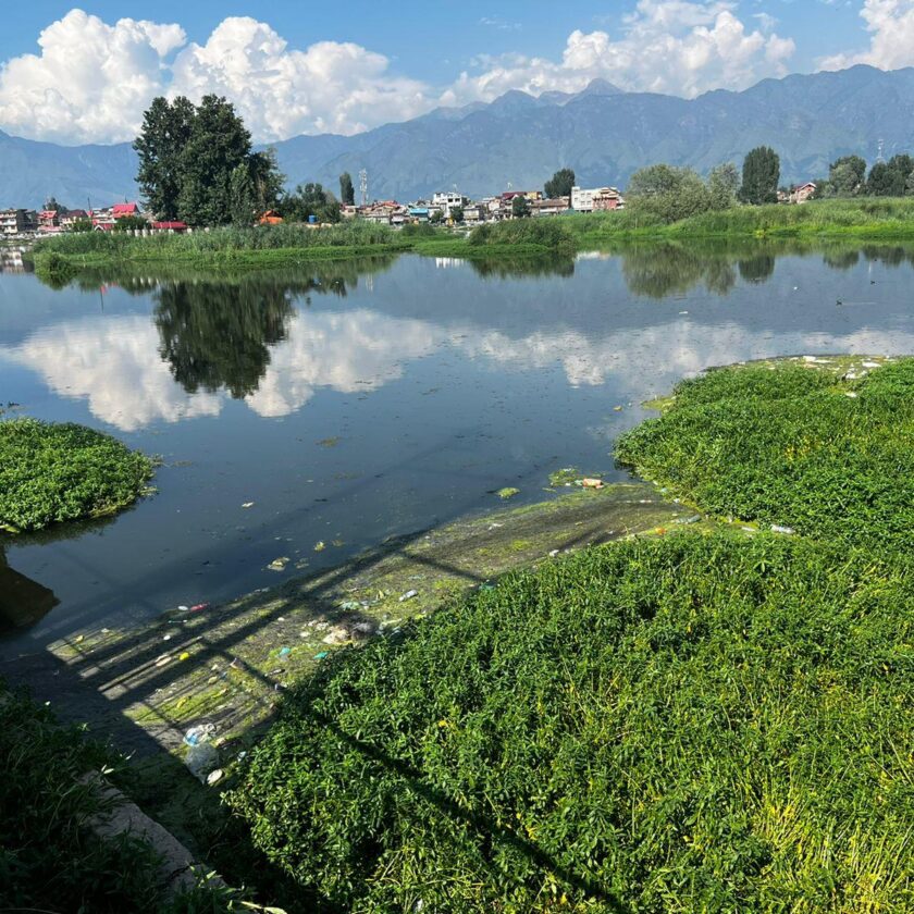
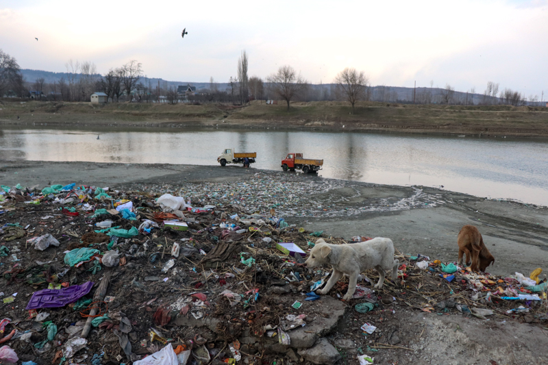
When wetlands disappear, drains narrow, natural channels are blocked and construction spreads into flood-prone areas, rainfall that once moved through the landscape becomes trapped.
The Ministry of Housing and Urban Affairs reiterated this broader principle in July 2026, noting that intense rainfall over short periods can produce urban flooding and that unplanned growth, encroachment of natural water bodies, inadequate sewer systems and inadequate drainage can compound the problem.
For J&K, the environmental message is straightforward:
Flood management cannot be separated from land-use planning.
Drainage projects, embankments and flood channels matter. But protecting wetlands, maintaining natural waterways and preventing construction in high-risk zones can sometimes provide more resilience than trying to engineer every drop of water away.
Srinagar Needs a Different Disaster Strategy
Srinagar’s risk profile deserves special attention because it combines dense urbanisation with the hydrological vulnerability of the Kashmir Valley.
The city is not simply vulnerable to river flooding. It can also face waterlogging and drainage congestion during intense rainfall.
This makes urban disaster management a multi-agency responsibility involving municipal authorities, flood-control agencies, police, health services, power departments, telecommunications providers and district administration.
In July 2026, the J&K administration formally constituted Urban Disaster Management Authorities for Jammu and Srinagar, signalling recognition that large cities require dedicated disaster-management structures rather than relying entirely on conventional district-level mechanisms.
The significance of these authorities will ultimately depend on what they do.
An urban disaster authority should have access to updated hazard maps, drainage data, building information, emergency routes and critical-infrastructure inventories. It should also be capable of conducting regular exercises involving hospitals, schools, municipal teams, police, fire services and utility providers.
A city discovers its coordination problems during a disaster only once.
After that, the cost is measured in lives.
The Government Has Started Building the Architecture — Execution Is Now the Test
There are signs that disaster management is receiving greater institutional attention.
The J&K Budget for 2026-27 announced an initial ₹39 crore Disaster Risk Mitigation Fund, six priority projects under the National Landslide Risk Mitigation Programme and the establishment of District Emergency Operations Centres across all 20 districts. A UT-level Emergency Operations Centre is being developed at Ompora in Budgam.
These measures point towards a shift from relief after disaster to mitigation before disaster.
That shift is essential.
But the CAG’s findings provide an important caution. J&K has already experienced situations in which resilience-related components were planned but not completed, equipment was procured but remained idle, and project monitoring was weaker than intended.
The new generation of disaster-management investments therefore needs measurable performance indicators.
How many vulnerable villages have functioning evacuation plans?
How many schools conduct annual disaster drills?
How quickly can a warning reach a village?
How many critical bridges and hospitals have been structurally assessed?
How many drainage channels have been mapped and cleared?
How many identified landslide zones have actual mitigation works rather than only warning boards?
These are more meaningful measures of preparedness than the number of meetings held or announcements made.
Community Preparedness Could Become J&K’s First Line of Defence
Technology can identify danger. Government machinery can mobilise resources.
But in the first critical minutes of a disaster, neighbours often reach one another before formal rescue teams do.
That makes community preparedness indispensable.
Village-level disaster management committees can maintain lists of vulnerable residents, identify safe buildings, mark evacuation routes, maintain basic emergency supplies and establish communication chains.
Schools should be treated as preparedness hubs rather than merely buildings where occasional awareness programmes are conducted.
Children can learn what an earthquake drill looks like, how to respond during a flood warning, why they should never cross a swollen stream and how to communicate an emergency.
The same knowledge travels home.
A disaster-aware child can become the messenger who tells a family that the warning is serious.
Disaster Management Must Also Become an Environmental Policy
There is another dimension often missing from emergency planning: ecosystem resilience.
Wetlands, forests, river floodplains, glaciers and mountain slopes are not merely environmental assets. They are part of J&K’s natural defence system.
A wetland that temporarily stores floodwater is infrastructure.
A stable forested slope that reduces erosion is infrastructure.
A functioning flood channel is infrastructure.
A healthy watershed that slows runoff is infrastructure.
The difference is that natural infrastructure does not always appear in a government budget as a conventional construction project.
Destroying it can make engineered infrastructure far more expensive.
The 2014 flood experience demonstrated precisely this relationship, with CWC identifying the disappearance and encroachment of natural flood-storage areas as factors that worsened inundation.
For a climate-stressed Himalayan region, environmental protection should therefore be considered part of disaster-risk reduction rather than a separate policy silo.
From Relief Culture to Resilience Culture
For decades, disaster management in many parts of India was dominated by a familiar sequence:
Disaster → rescue → compensation → reconstruction.
That model remains necessary. People affected by disasters need immediate relief, shelter, compensation and rehabilitation.
But it is not enough.
The more sustainable model is:
Risk mapping → prevention → early warning → evacuation → response → recovery → stronger reconstruction.
J&K has begun moving in this direction.
The creation of mitigation funding, expansion of Emergency Operations Centres, landslide-risk projects, urban disaster authorities and vulnerability mapping all point towards a more proactive system.
The challenge is ensuring that these initiatives do not remain isolated administrative programmes.
A warning system must connect to an evacuation plan.
An evacuation plan must connect to a safe shelter.
A safe shelter must have power, water and communications.
A disaster map must influence construction decisions.
A post-disaster audit must influence the next infrastructure project.
And every major disaster must leave behind not just compensation files, but institutional memory.
The Real Test Will Come Before the Next Disaster
Jammu & Kashmir cannot control when the next cloudburst strikes, when an earthquake occurs or how much rain falls on a mountain catchment.
It can control how exposed people are when it happens.
That means protecting floodplains, enforcing safer land-use practices, maintaining drainage, strengthening bridges and critical buildings, expanding reliable warnings, improving slope monitoring and ensuring that evacuation plans work outside government files.
It also means accepting an uncomfortable truth: preparedness is successful when nothing dramatic happens.
A village evacuated before a flash flood is not a failure of administration. It is a success.
A school drill that teaches children how to respond before an earthquake is not a ceremonial exercise. It is an investment in survival.
A wetland protected from construction may look like unused land on a development map. During a flood, it can become one of the most valuable pieces of infrastructure in the region.
The mountains will continue to move. Rivers will continue to rise. Weather will remain uncertain.
Jammu & Kashmir’s choice is not whether disasters can be eliminated.
It is whether the next extreme event finds the region unprepared, partially prepared or genuinely resilient.
The difference between those three states could be measured in homes, livelihoods and human lives.
For a Himalayan region already carrying the memory of 2014, that is a difference J&K can no longer afford to leave to chance.