Water level receding, no need to panic, monitoring situation, position better than morning: Govt; Record-break 24-hr rainfall in Pahalgam, Banihal; Qazigund, Kokernag, Gulmarg record 2nd highest 24-hr precipitation in July month
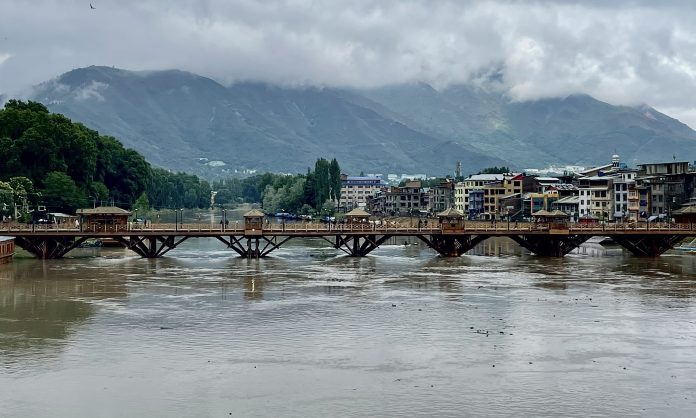
The water level has crossed the “flood alert mark” in river Jhelum, creating panic among the masses, who have witnessed devastating floods in 2014. The water level increases amidst the incessant and intermittent rainfall in Jammu and Kashmir parts for the second consecutive day on Saturday while as the government has said that there was no need to panic as the situation is being monitored closely.
The record-break 24-hour-rainfall was recorded at multiple places in J&K in the month of July, which include Pahalgam and Banihal while Gulmarg, Qazigund and Kokernag recorded the second highest 24 hour precipitation.
In Pahalgam, 73.3 mm rainfall was recorded in 24 hours, which is the highest-ever 24 hour precipitation in the month of July so far. The previous highest was 60.4 mm, which was recorded on July 16, 1983, an Independent Weather Forecaster, Faizan Arif Keng told the news agency,
Banihal also received record-breaking 24 hour precipitation with 103.0 mm, where the previous highest was 83.0 mm on July 25, 1995.
However, Qazigund has recorded second highest 24 hour rainfall today at 94.0 mm while Kokernag and Gulmarg also recorded second highest 24 hour precipitation at 76.3 mm and 42.4 mm respectively.
The rainfall that started on Friday evening has increased the water in the river Jhelum and other tributaries. The water was flowing above the flood alert mark at 10:00 PM.
At Sangam, the water till 10:00 PM has risen to 21.55 ft, which is nearly one ft above the flood alert mark and 4 ft below the flood declaration mark. In Pampore also, the water has increased to 4.86 ft, which is above the flood alert mark. The flood declaration mark in Sangam and Pampore is 25 ft and 5 ft respectively.
At Ram Munshi Bagh, the water was flowing below the alert mark as it has risen to 17.49 ft while the alert mark is 18 ft. At Asham, it was flowing near 11 ft, which is 3 ft below the flood alert mark.
The water level has however; receded in nallah Vishow at Khudwani as it was flowing below the flood declaration mark when the report was last filed. The water level in Rambiyara, Doodhganga and Sindh was flowing below the flood declaration mark.
However, the Irrigation and Flood Control Department (I&FC) department has stated that the situation is being monitored and there was no need to panic.
Chief Engineer, I&FC, Naresh Kumar told that so far no report of any untoward incident has been received amid the rise in water level in river Jhelum and other tributaries.
He added that the advisories have been issued in every district almost and the staff has been asked to remain on night patrolling.
Kumar further stated that the water is still flowing below the alarm level and there was no need to panic. “The position at present is much better than in the morning. The water level is receding at present as the rains have stopped now,” he said.
“With full confidence I am telling the people that they should not panic as the department is here to tackle the situation and monitor it very closely,” Kumar said.
Earlier, in a day, Kumar issued a circular, in which the Flood Zonal Committees were directed to remain alert in their respective jurisdictions and monitor the situation closely.
“In view of forecast of heavy rains predicted by the Meteorological Department from 08-07-2023 to 09-07-2023 all the Flood Zonal Committees are directed to remain alert in their respective jurisdictions and monitor the situation closely,” the circular reads.
It added that the committees will keep the flood fighting machinery in readiness for their immediate mobilization in the event of any flood like situation.
Moreover, the intermittent rainfall lashed Srinagar and adjacent areas also, submerging the roads as well as bringing the mercury down across J&K.
Director Meteorological department, Sonum Lotus told KNO that the intermittent light to moderate rain and shower would likely occur at most places of Jammu & Kashmir with possibility of heavy to very heavy showers at isolated places of the Union Territory.
He added that snowfall is also expected over higher reaches.
On July 09, he said there is a possibility of intermittent light to moderate rain and showers at many places of J&K with possibility of heavy showers at isolated places of Jammu region as well.
From July 10-14, Lotus said that as per the forecast, the weather conditions would improve from July 10 but light rain or thunderstorms at isolated places can’t be ruled out.
He added that with the possibility of more rains, there is a risk of flash floods, landslides, mudslides at vulnerable spots and lower catchment areas.
Asking people to stay alert, Lotus said that the temporary disruption of surface transportation over Srinagar-Jammu NH, Mughal Road, Srinagar-Leh NH and other major hilly roads can also be witnessed during the period
Lotus advised people to stay indoors while thunder, lightning and avoid venturing near fast flowing water bodies.
Meanwhile, the State Disaster Rapid Force (SDRF) is on high alert and has prepared Quick Response Team (QRT) teams and boats for immediate emergency action.
We are fully prepared for any potential flood situation as the water level in the River Jhelum is expected to exceed the flood mark. We have boats, QRT teams, and other necessary equipment ready for action, said officials.
“Our QRT teams, supported by various machines and boats, are fully prepared to handle any kind of emergency. There is no need to worry as we are proactive and vigilant,” they said.