• Gulmarg, Pahalgam could show a rise of 4-7 degrees Celsius by century’s end: Study
• ‘Climate change may lead to sweeping vegetation changes in Valley’
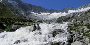
Kashmir valley is heading towards a widespread transformation in its flora population due to global warming which could jeopardise water resources and species unique to the Himalayan region, a study has warned.
 Researchers from University of Kashmir, Indian Institute of Science (IISc) and Jawaharlal Nehru Technological University, Bangalore estimated the maximum and minimum temperatures in two stations they studied, Gulmarg and Pahalgam, could show a rise of 4-7 degrees Celsius by the end of the century.
“The rise in temperature would lead to sweeping vegetation changes, with shrubs and tundra forests replacing icy regions, and savannahs invading newer areas,” the study said.
However, rain and snowfall is not expected to change much, according to the findings published in the journal ‘Climatic Change’.
The team undertook three lines of analysis – they mapped the present types and distribution of plants growing in this region; examined weather data to study changing climate signals; and attempted to predict the vegetation distribution and composition of this region for the rest of this century. Their study area spanned around 200,000 square km.
ALTERATION IN FLORA
“Our assessments indicate that grasslands and tropical deciduous forests in the region would be severely affected while areas presently under cold desert/rock or ice would be colonized by steppes, shrubs and at certain places by forests in the worst case scenario,” Irfan Rashid, lead author of the study and assistant professor at the Department of Earth Sciences, University of Kashmir, told the environmental news portal thethirdpole.net.
“Our modelling experiment predicted that a substantial area of land, presently under the permanent snow and ice cover, would disappear by the end of the century which might severely impact stream flows, agriculture productivity and biodiversity in the region,” he said.
Further, the report says the temperate evergreen forests are likely to be colonized by temperate deciduous forest. Temperate evergreen broadleaf forests and mixed forests may replace open shrub lands.
Additionally savannahs could also invade the area, with widespread growth of savannahs/steppes and the reappearance of temperate evergreen coniferous forests as well as shrub lands by the end of the century.
The scientists concluded that the changes in the distribution of vegetation may also jeopardise services and products unique to the livelihoods in this region. Carbon stored in vegetation and soil may also be released into the atmosphere as these changes occur.
“People, especially tribal communities, living in the forested and alpine landscapes (more than 2,500m above sea level) directly depend on forested and pasture lands for their livelihood especially when it comes to the dependence on timber, firewood, medicinal plants, and grazing of cattle in the lush green pristine alpine pastures,” Rashid said.
“Our analysis indicated that in view of changing climate, such ecosystems could be severely impacted which will not only alter the species distribution patterns and biochemical cycling within such ecosystems but strongly pose a threat to the livelihood of such tribal communities.”
The impact on ecosystems is in line with a previous study on a “massive ecosystem shift” by the Kunming Institute of Botany. The team’s findings also assume significance given the paucity of data from the Himalayas, a startlingly steep mountain range that rise from 300 metres to over 8,000 metres, and pose severe challenges for collecting data on climate, soil and vegetation.
The team based their predictions on a computer model called “Integrated Biosphere Simulator” (IBIS), which is one in a group of highly advanced computer model-based tools to assess the impact of climate change on terrestrial ecosystems including forests. These models represent ecosystem dynamics on ground in response to environmental changes.
To map the area, they used data from the US National Oceanic and Atmospheric Administration high resolution radiometre. They also used observed meteorological data from 1979 to 2010 on temperatures, stream flow and precipitation for Pahalgam and Gulmarg.
They found that between 1980 and 2000, minimum temperatures in this region rose faster than maximum temperatures. There was a decrease in precipitation rates, but that was insignificant.