
Jammu and Kashmir’s first Disaster Management Plan reveals that Kashmir may witness more spells of extreme rainfall, with southern districts of the Valley being more vulnerable to floods.
 The plan was approved by Chief Minister Mufti Muhammad Sayeed on Friday. It states that authorities need to plan in a proper way to meet exigencies.
The SDMP reads that considering recent extreme rainfall episodes as an anomaly, return period analysis suggests that most of the southern districts of the Valley may experience frequent “extreme episodes”.
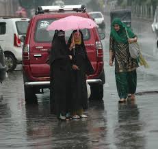
Since last year’s floods, Kashmir has been witnessing freaky weather, with incidents of cloudbursts, excessive rainfalls, flood scare haunting the populace.
“Although a detailed exercise is required to model the future more accurately together with scenario based uncertainties; this analysis provides an indication that the state authorities should plan for extreme rainfall in the region, particularly for the Southern districts, which are the most populated and also close to the drainage network,” it reads.
“Analysis of long term daily rainfall of the region, using 25 km IMD gridded data, for the period 1951 to 2013, suggests that heavy rainfall like that September 2014 has been unprecedented in the past record,” the state approved plan reads.
The report raises alarm bells by stating that after study of various climate models, it is observed that in future there is increased possibility that more frequent events of extreme daily rainfall in Kashmir.
It mentions that analysis of annual maximum rainfall suggests that most of the Southern district of Kashmir valley has around 5 year return period for annual maximum daily rainfall exceeding 64.5 mm. “Climate model analysis, using MIROC 4h data (which has a spatial resolution of 50km by 50km), for the period 2006-2035 under RCP 4.5 scenario suggests that the return period of annual daily rainfall exceeding 64.5 mm threshold will further decrease for most regions of the state. This implies that, according to climate models, in future there is increased possibility that more frequent events of extreme daily rainfall will be witnessed.”
The plan prepared by Tata Institute of Social Sciences (TISS) Mumbai states that Jammu and Kashmir has a very peculiar geography and climate. Most of the valley regions of the state are fed by rivers like Jhelum, Indus and Chenab. Low-lying areas of the Kashmir, especially Srinagar along with parts of Jammu are prone to floods that occur due to heavy rainfall in upper catchment areas.
“Recent heavy rains, in September 2014, caused devastating floods that claimed at least 280 lives, and stranded hundreds of thousands of residents. Recent flood in the state is unprecedented in nature, where most part of the Southern districts received very high rainfall. Weekly total rainfall for most of the stations for the period Sept 2 to Sept 8, 2014 was more than 200 mm. This is very high for a terrain like Jammu and Kashmir.
According to the Indian Meteorological Department, Kashmir has shown rise of 1.45 degree Celsius (in average temperature) whereas Jammu region has shown a rise of 2.32 degree Celsius in the past two decades.
The plan suggests remedial measures to safeguard the lives and properties and develop strategies, both structural and non-structural, required for flood mitigation which consists of techno legal regime, capacity building, safety audit, planning, adaptation to new technology and others. Structural measures are in the nature of physical measures and help in dealing with the physical event of the floods and altering its nature. These are measures which are taken to protect people and property, which counteracts the flood event in order to reduce the hazard or to influence the course or probability of occurrence of the event.
“These measures can be aimed at reducing discharge (reservoir, diversion, and watershed management), reducing stage (channel improvement), reducing existing damage susceptibility (levee or floodwall, flood proofing, relocation, flood warning and preparedness planning) and in reducing future damage susceptibility (land-use and construction regulation, acquisition).